On This Page
What RTK, GCPs, and checkpoints each do
Real-time kinematic positioning, or RTK, uses satellite observations and
corrections from a base station or reference network to improve the positions
recorded during image capture. Photogrammetry software combines those positions
with overlapping images to reconstruct the scene. Post-processed kinematic
positioning, or PPK, applies corrections after capture and requires suitable
recorded observations and a supported processing workflow. Neither method
directly measures every point on the finished surface.
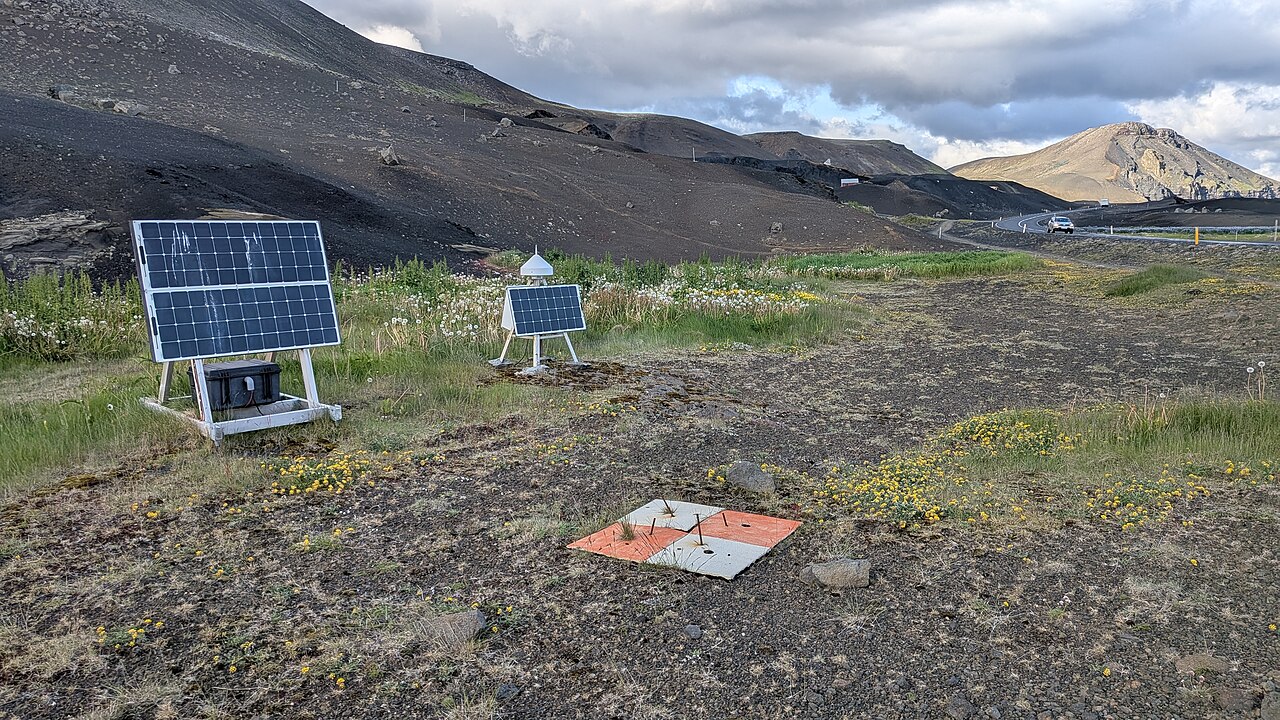
A ground control point is a recognizable location with surveyed coordinates
that the processing software uses to constrain the model. A checkpoint has
surveyed coordinates held out of that adjustment; comparing its reconstructed
and surveyed positions tests the result. The physical target can look identical.
Its assigned role in processing determines whether it is control or a check. See
PIX4D's
explanation of control and check points.
Consequently, a proposal for “zero GCPs” can still include substantial ground
measurement. Ask how many points constrain the model and how many remain
reserved for assessment. A small residual at a point the software was told to
fit is not an independent test of the surrounding map.
Also separate relative accuracy, the agreement of dimensions and positions
within a model, from absolute accuracy, its agreement with the required
coordinate reference frame. A model can preserve useful internal dimensions
while sitting in the wrong location. PIX4D's
accuracy guidance
distinguishes these properties and explains why image quality and reconstruction
still limit an RTK dataset.
When to retain ground control
Choose the control approach from the required output and the conditions that
could invalidate it. The following table is an editorial synthesis of the
technical guidance and field studies cited below, checked September 7, 2026. It
is a scoping aid, not a prescribed target count.
Scroll horizontally to compare all columns.
GCPs cannot repair missing image detail. Blur, occlusion, poor overlap, and
difficult surfaces can impair reconstruction even when positioning is good.
Likewise, ground sampling distance, the ground length represented by a pixel, is
a resolution measure rather than proof of positional accuracy. The
USGS calibration guidelines
connect geometric quality to control, camera calibration, tie points, and
acquisition geometry.
Before adding control to correct a consistent height offset, confirm the height
reference. Ellipsoidal heights and orthometric heights refer to different
surfaces. Image positions, surveyed points, and exported deliverables need
compatible coordinate definitions and the appropriate transformation. PIX4D's
geoid guidance
explains why a constant height shift is only suitable under limited conditions.
Check the capabilities of the particular software and version being used.
What no-GCP research actually demonstrates
There is credible evidence that GCP-free RTK mapping can work. In a
2020 River Feshie study by Stott, Williams, and Hoey,
researchers flew a DJI Phantom 4 RTK over a roughly 2 by 0.5 km river reach.
They used a double grid with imagery angled 20 degrees from nadir and assessed
the outputs against 3,300 spatially distributed RTK-GNSS checkpoints.
The no-GCP scenario produced a vertical root mean square error of 0.066 m,
compared with 0.072 m for the five-GCP scenario. Neither scenario showed the
systematic vertical doming discussed in some other investigations. Those results
demonstrate a successful configuration under the study's conditions. They do not
establish that removing GCPs improves accuracy generally, or that another
aircraft, camera, site, and flight plan will reproduce the result.
Other research helps explain why outcomes vary. A
2021 study by Obanawa, Hayakawa, and Sakanoue
examined RTK surveys without GCPs and found that camera angle, camera-position
accuracy settings, and lens-calibration treatment affected doming and vertical
error. Doming is a broad curvature error in the reconstructed surface;
accurately positioned photographs do not automatically rule it out.
The purchasing implication is to request a representative trial with independent
ground checks. A study can establish feasibility. Your own delivery requirements
determine whether its errors would be acceptable for your job.
Plan the fieldwork before reducing targets
Start with the recipient's intended use: an orthomosaic for visual context, a
surface for earthwork measurements, or data that must align with an engineering
model. Agree the horizontal and vertical error measures, units, required
coverage, coordinate system, height reference, and any named standard and
edition. Set the point-count and distribution requirements before capture rather
than choosing them after seeing the result.
Then assemble the inputs needed to produce and check that output:
- Positioning records: identify the RTK correction source, its coordinate
reference, and the basis for any local base coordinates. Retain the image
geotags and available positioning-quality records. If PPK is a contingency,
confirm that the aircraft records the necessary observations and exposure
information before flying.
- Ground measurements: establish suitable surveyed points, record
coordinate units and measurement uncertainty, and assign control and check
roles. Plan recognizable, stable targets across the area and elevation range
that matters to the deliverable. Keep a record of target IDs and field
observations.
- Capture and processing settings: document the camera, flight geometry,
overlap, software version, calibration approach, and treatment of
image-position uncertainty. Preserve the images and settings needed to
reproduce the output.
These are proposed handover requirements drawn from the cited positioning and
calibration guidance. Their purpose is to make the service reproducible and to
expose gaps before the crew leaves the site. Also ask how the reference survey
was verified: as a matter of measurement logic, if the drone and checkpoint
survey inherit the same wrong base coordinate or transformation, their agreement
alone cannot reveal that shared mistake.
After capture, inspect the images and correction-quality records before
committing to a no-GCP solution. An “RTK-equipped” aircraft label does not show
whether all exposures received suitable corrections. PIX4D's
published RTK/PPK field comparison
describes unevenly distributed float positions during interrupted corrections
and the resulting local accuracy problems. Its site-specific results are a
reason to examine where degraded positioning occurred, rather than accepting one
flight-wide percentage.
Process with the intended control set and evaluate the held-out points. If a
failed checkpoint is used to adjust the model, it becomes control for that
version. Preserve other independent checks or collect additional measurements
before claiming the revised model passes. Record rejected measurements and the
reason for rejection; do not simply remove the largest errors to improve the
report.
Read the accuracy report correctly
Require separate results for the GCPs used in adjustment and the checkpoints
used for assessment. The checkpoint table should identify each point, its
surveyed and reconstructed coordinates, signed differences, and whether it was
included in the final statistics.
For vertical differences defined as model height minus surveyed height, the
basic calculations are:
Mean vertical error = sum of vertical differences / number of checkpoints.
Vertical RMSE = square root of the mean of the squared vertical differences.
Mean error exposes a common shift. RMSE reflects error magnitude, including both
bias and scatter. Neither is the maximum error, and neither establishes a
confidence level without the relevant statistical method.
For illustration only, suppose four checkpoint differences are +0.02, -0.02,
+0.04, and -0.04 m. Their mean is 0 m, while their vertical RMSE is
sqrt((0.0004 + 0.0004 + 0.0016 + 0.0016) / 4) = approximately 0.032 m, rounded
to the nearest millimeter. The errors cancel in the mean while remaining present
in the surface. These hypothetical inputs are not a flight result or a
recommended sample size.
Ask for a map of the checkpoint differences as well as summary statistics. A few
good checks near the launch area do not establish accuracy across an untested
corridor or hillside. The River Feshie researchers specifically recommend
spatially distributed independent checkpoints to detect systematic errors.
Finally, verify the product actually being delivered. A reconstructed checkpoint
report and a finished ground-surface check answer related but different
questions. If the order specifies a terrain surface, agree how its elevations
will be compared with suitable ground measurements, including areas where
vegetation or reconstruction artifacts complicate interpretation. USGS describes
both control-based calibration and checks on data quality; our explanation of
what drone inspection evidence can establish
develops the broader distinction between an image, a measurement, and a
supported conclusion.
Questions to put in the supplier brief
Ask the supplier to answer these before quoting a reduced-control workflow:
- Which points will adjust the model, and which will remain independent checks?
- What coordinate system, height reference, units, and transformations will the
deliverables use?
- Which horizontal and vertical statistics will determine acceptance, and how
will the checkpoint survey's uncertainty be reported?
- How will checks cover the delivered area, terrain types, and elevation range?
- What happens if corrections fail or the first output misses the agreed error
limits? Who supplies the additional measurements or reflight?
- Will delivery include the point-role list, per-point errors, spatial error
map, processing report, and the requested orthomosaic or surface files?
Compare proposals on that complete scope. A quotation with fewer adjustment
targets may still include checkpoint surveying, correction services, processing,
and recovery work. No general savings percentage follows from choosing RTK.
Use RTK to reduce ground control where a representative workflow and independent
checks justify it. Keep GCPs where they are required or demonstrably useful, and
make verification part of the job from the beginning. The useful commercial
outcome is an accepted mapping deliverable with known limits.
Source notes
- PIX4D: RTK and PPK workflow.
Software-provider documentation on correction methods, processing inputs, and
checking RTK/PPK results.
- PIX4D: Tie points in a photogrammetry project.
Technical documentation distinguishing adjustment control from checkpoints.
- PIX4D: Relative and absolute accuracy of drone mapping.
Definitions and reconstruction limits; expected accuracy is conditional.
- USGS: Guidelines for Calibration of Uncrewed Aircraft Systems Imagery.
Government technical report, 2023-1033, covering acquisition, control,
calibration, and data-quality checks.
- PIX4D: Outputs with respect to a geoid model.
Height-reference principles and conversion limitations; software capabilities
differ by product.
- Stott, Williams, and Hoey: Ground control point distribution for accurate kilometre-scale topographic mapping.
Peer-reviewed 2020 field study of one RTK aircraft and river survey
configuration.
- Obanawa, Hayakawa, and Sakanoue: Methods to reduce doming without GCPs in RTK-UAV surveys.
Research paper, 2021, relating image geometry and processing choices to
vertical error.
- PIX4D: RTK vs PPK drones vs GCPs.
Provider's field comparison, updated January 31, 2022, illustrating correction
interruptions and spatial variation in error.
Last checked: September 7, 2026.