On This Page
What makes the model a digital twin?
The Digital Twin Consortium's definition centers on a representation that stays
synchronized with its real-world subject at a specified frequency and fidelity.
Its explanation allows observation-driven updates, human participation, and
different update intervals for different information. Continuous streaming and
automatic equipment control are therefore not prerequisites under this
definition.
Read the consortium's definition.
That gives buyers three useful distinctions:
- Reality capture records an observed condition. Photographs, a point cloud,
or a textured mesh can provide a dated spatial baseline.
- An asset model connects observations to named, identifiable things and
their relevant attributes or relationships.
- A maintained twin has an agreed mechanism for bringing those records back
into alignment with the asset as it changes.
These are practical procurement distinctions, rather than universal product
categories. A bridge deck might need new geometry after repair, while a
connected instrument supplies readings more frequently. The refresh interval
should follow the decision and how quickly its underlying information becomes
obsolete.
Also distinguish a twin of a facility captured by a drone from a twin of the
drone itself. This article covers the first: the aircraft is a data-collection
tool, not the asset being modeled.
Start with an operational question, such as locating roof equipment for
maintenance planning or documenting accessible surfaces before and after a
repair. Translate that question into required coverage, detail, positional
checks, and record fields. Ask the recipient which surfaces and asset attributes
would make the delivery unusable if absent.
For image-based reconstruction, the technical inputs include overlapping images,
camera geometry, and camera positions and orientations. Flight paths, viewing
angles, exposure, and image sharpness affect what can be reconstructed. Pix4D's
acquisition guidance treats these as project-design choices and provides
different capture patterns for different subjects.
See the image-acquisition guidance.
A roof survey and a facade model need different views. Downward-looking
photographs alone should not be specified as complete exterior coverage. Plan
additional perspectives where the required surfaces are obscured, and record
inaccessible areas explicitly. Neither attractive textures nor software-filled
holes establish that an unseen surface was observed.
Request the following inputs in the statement of work:
- Asset context: the site boundary, asset register, existing drawings or
building information model, and the system used to manage maintenance.
- Spatial reference: coordinate system, units, vertical reference, survey
control, and the agreed transformation into any existing model coordinates.
- Capture record: original observations, acquisition times, sensor
identification, positioning information, and any processing prerequisites.
- Measurement requirements: the quantities to be measured, the relevant
accuracy requirement, and independent checks appropriate to those quantities.
- Information ownership: the person who resolves asset identities, accepts
observations, and decides when a new version becomes current.
Ground sampling distance describes image detail. It does not, by itself,
establish the positional accuracy of the delivered model. USGS calibration
guidance identifies ground-control accuracy and tie-point quality as
contributors to geometric accuracy regardless of image ground sample distance.
It also recommends preserving calibration parameters and their uncertainties in
metadata.
Read the USGS calibration report.
For the contract, keep the resolution specification and the measurement
requirement separate. A buyer asking for a clearly recognizable component is
asking a different question from one asking for a checked coordinate or
displacement. Likewise, distinguish surveyed control used to fit the
reconstruction from independent checkpoints reserved to assess it.
Turn observations into an asset record
The commercial workflow has a capture stage, a reconstruction stage, and an
integration stage. Photogrammetry finds corresponding features across
overlapping photographs and uses their viewing geometry to reconstruct spatial
positions. USGS describes this mechanism in its work on historical coastal
imagery. The resulting point cloud represents reconstructed points; producing a
surface model and making it useful to an asset-management team require further
work.
See the USGS reconstruction example.
After processing, check coverage and alignment before assigning operational
meaning. A patch of textured geometry does not inherently identify a particular
pump, explain its maintenance history, or establish which service area it
supports. Link relevant geometry and observations to the owner's asset
identifiers, and retain an unresolved status where identification cannot be
confirmed.
As a concrete platform example, Microsoft documents Azure Digital Twins as model
instances with properties and relationships. Its data representation includes a
twin identifier and distinguishes a property's processing time from an optional
time of observation. That illustrates the information layer a spatial viewer
must connect to; it is not a claim that a drone export automatically creates
those relationships.
Read Microsoft's twin-graph documentation.
Consider an illustrative roof-maintenance handoff. The owner identifies a
rooftop unit as AHU-17. A new capture produces a mesh version, and the
reviewer attaches an observation to that unit with its source photograph,
observed date, location, and review status. A maintenance request references the
same asset identifier. The next capture should add a new observation to that
history without severing the earlier request's connection to its original
evidence.
The identifier should survive a replacement mesh. Conversely, physically
replacing the equipment should follow the owner's asset-retirement and
replacement rules, rather than silently transferring the old unit's history to a
new machine.
Agree which application owns each field. For example, the maintenance system may
own work-order status while the capture platform owns image references. Require
an explicit rule for conflicting updates. A simple export-and-import procedure
can be sufficient if it preserves those responsibilities and is practical at the
required update frequency.
Require measurable deliverables
The following is a suggested delivery schedule for procurement. It combines the
cited capture, accuracy, and information-model principles with editorial
recommendations. The buyer and responsible technical specialists must set
project-specific numerical limits before collection.
Scroll horizontally to compare all columns.
The point of this schedule is to make missing work visible. A supplier might
complete the reconstruction while leaving the asset matching to the owner. That
can be a valid scope, provided responsibility and effort are explicit before
acceptance.
For positional assessment, Pix4D distinguishes relative accuracy, such as
dimensions within a model, from absolute accuracy, which concerns positions
in a reference frame. It recommends checkpoints to assess absolute accuracy and
warns that certain surfaces can be less accurate locally. A single project
summary therefore deserves closer examination where a critical measurement is
involved.
Read the accuracy guidance.
Checkpoint results support the tested positional claims. They do not
automatically validate every asset label, visible defect, or inaccessible
surface. Require the report to identify where its checks apply, rather than
extending a ground-level result to all elevated or vertical surfaces. For the
distinction between an observation, a checked measurement, and a diagnosis, see
what drone-inspection evidence can prove.
For large spatial datasets, OGC's 3D Tiles standard supports streaming and
rendering content such as photogrammetry and point clouds. This addresses
delivery to a viewer. It does not establish that an export preserves the owner's
maintenance relationships or update process.
See OGC's 3D Tiles standard.
Ask the supplier to demonstrate both viewing and data reuse in the recipient's
actual application. A file opening successfully is only the first step; asset
identifiers, coordinates, attributes, and source-image connections must survive
wherever the contract requires them.
Keep updates comparable and traceable
Treat each capture as a dated observation set. Keep acquisition time, processing
time, and acceptance time separately, and show users the age of the information
they are viewing. A recently uploaded model can contain old imagery.
Define a refresh trigger for each use case. A construction team might request a
capture at a project milestone. A facility team might refresh geometry following
equipment replacement and retain separate condition observations between
geometric updates. These are example schedules to agree with the owner, not
recommended universal intervals.
Before comparing two models, check that they share a compatible coordinate basis
and that the alignment is supported by stable features or control. Record
coverage changes and differences in processing. Apparent movement can reflect
registration error or reconstruction differences rather than physical change.
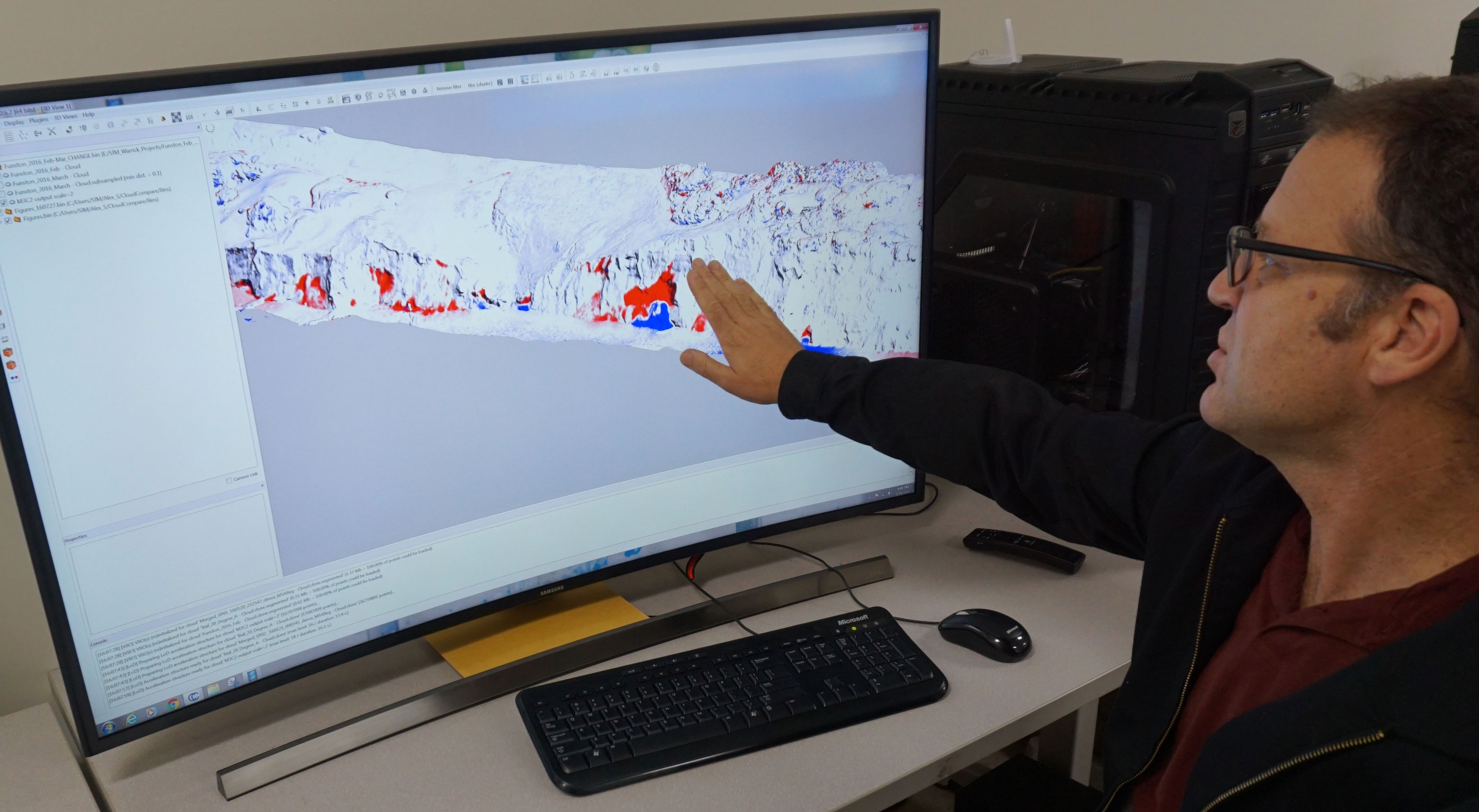
USGS's coastal work demonstrates the value of comparing dated reconstructions,
but its particular research results do not establish a detection limit for a
commercial site.
For a proposed change-detection service, request the smallest reportable change,
the method used to justify it, and how uncertain areas will be labeled. Have the
team distinguish a surface that changed from one that was not adequately
observed on one visit. Avoid treating a blank area as proof that nothing
changed.
Ordinary exterior imagery also cannot establish hidden wall thickness, internal
corrosion, or structural capacity. If a twin will support an engineering
calculation, require the additional inspection inputs, material information,
assumptions, and model validation appropriate to that calculation. A
reconstruction can help locate evidence without being sufficient evidence for
the final diagnosis.
Operationally, preserve earlier observations and their source files when
accepting an update. Give the owner a way to inspect the prior state, identify
who accepted the change, and recover a usable earlier version. Define what
happens when an update fails checks: who requests rework, which information
remains current, and how users see that a refresh is overdue.
Choose the scope and test the handoff
Commission a dated capture when the job is a one-time visual record. Add
asset-level structure when users need to find equipment and connect observations
to work. Fund a maintained twin when repeated decisions justify ongoing capture,
data management, and integration. This is a scope recommendation derived from
the functions above, not a ranking of software products.
Before selecting a service, ask:
- Which decisions will the delivered model support, and which will need
additional evidence?
- Who supplies and confirms asset IDs, attributes, spatial reference, and
inaccessible-area records?
- Which checks apply to the final deliverable, and who pays for reprocessing or
recollection after failure?
- Can a user move from a selected asset to its original observation and
maintenance record?
- What survives export, supplier replacement, or the end of a hosting
subscription?
- Who performs the next update, resolves conflicts, and maintains the
integration?
Request separate scope and pricing for capture, processing, asset
identification, integration, hosting, and recurring updates. Compare proposals
over the same operating period and update schedule. Otherwise, a low initial
capture price can conceal substantial work retained by the buyer.
Use a representative portion of the site for the handoff demonstration. Include
an obscured surface, an asset needing manual identification, and a second
observation of an already recorded asset. Have the intended maintenance user
retrieve the evidence, connect it to the correct record, and revisit the earlier
version. Record completion time, failed lookups, and manual corrections against
the agreed task; these measurements make the demonstration more useful than a
guided viewer tour.
Buy the smallest scope that completes that task reliably. The first model
establishes the baseline; the second update shows whether the asset model can
actually be maintained.
Source notes
Last checked: September 7, 2026.