On This Page
Set the scope before requesting a quote
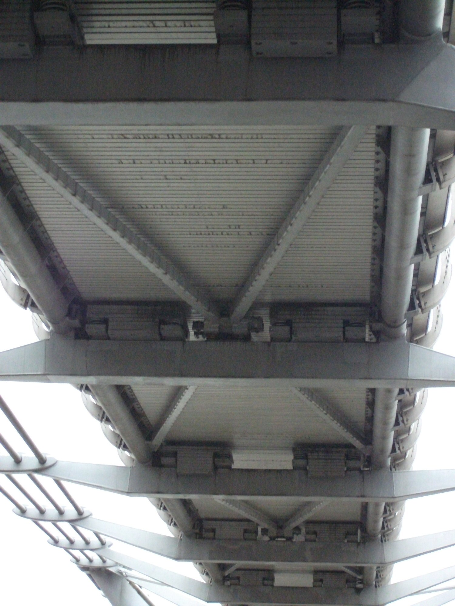
Start with a sentence that names the decision: “Document the accessible exterior
faces of these components so our maintenance engineer can select locations for
closer examination.” Replace that example with your actual objective, such as
establishing a baseline, locating visible deterioration, checking completed
repairs, or measuring a defined surface.
Send each bidder the same scope sheet:
- Asset identity: site address, asset register IDs, drawings, component
names, and a marked boundary for the work.
- Inspection question: the condition or change you need to investigate and
the decision that will follow.
- Required views: the component faces, elevations, connection details, and
surrounding context the reviewer needs.
- Existing evidence: previous photographs, reports, known defects, repair
records, and the dates of relevant changes.
- Technical reviewer: the person who will interpret the material and agree
whether it is sufficient.
- Delivery requirements: file formats, asset-management fields, due date,
retention period, and access arrangements.
- Exclusions: inaccessible surfaces, internal conditions, measurements, or
professional opinions outside the assignment.
Make the component list the basis for counting coverage. “Inspect the building”
leaves too much open: does it include every facade, roof edge, drainage outlet,
and equipment enclosure? Mark each required area on a drawing, then give it a
matching entry in the delivery schedule.
Keep collection and judgment distinct. For U.S. bridge inspections,
FHWA's inspection-procedure guidance
describes drones as a supplement and identifies limitations such as the
inability to perform tactile examination or sounding. That bridge-specific
guidance illustrates why a service scope must identify the work that still needs
another access or inspection method.
If your team is unsure whether it needs an observation, measurement, or
diagnosis, use the
six levels of drone-inspection evidence
to settle that question before specifying outputs.
Match the sensor to the question
A drone carries the sensor to a viewpoint. The sensor records information;
processing organizes or measures it; a reviewer interprets what the information
supports. Failure at any stage can leave a visually impressive report unable to
answer the owner's question.
Visual imagery: specify the detail that must be visible
For visible-light photography, name the smallest feature the reviewer needs to
distinguish and ask for representative original images at the proposed working
distance. A whole-asset overview provides location context; detailed images
provide the closer view. Require the two to be linked.
NIST's target-size guidance
explains that discernible detail depends on the target's size in the camera's
field of view, which varies with distance, optics, and the target itself. It is
general video-quality guidance, not a drone crack-detection specification. A
camera's megapixel count alone therefore does not establish that your required
feature will be recognizable.
Have the reviewer evaluate focus, glare, shadow, motion blur, and obstructed
views in the sample. Agree the capture conditions under which the work remains
useful. Do not accept an unsupported promise to detect every crack or every
loose connection.
Thermal imagery: require the conditions behind the colors
Thermal cameras infer surface temperature from infrared radiation. Emissivity,
meaning how effectively a surface emits that radiation, and reflected radiation
influence the reading. FLIR's
thermographic measurement guidance
also identifies distance, atmospheric temperature, and humidity as relevant
measurement inputs.
For a temperature-analysis assignment, request the original radiometric files,
which retain measurement data, paired visual views, relevant settings, and a
record of asset operating conditions. Ask the specialist to define suitable
capture conditions for the application and explain how suspicious patterns will
be checked.
A colored hotspot is an observation requiring interpretation. Specify whether
the service includes screening, quantitative temperature analysis, or fault
investigation. Those are different deliverables; do not buy one while expecting
all three.
Maps and models: separate detail from accuracy
An orthomosaic is an assembled image map; a 3D model represents reconstructed
geometry. If either will support measurements, specify the quantity being
measured, units, coordinate reference where relevant, and the permitted error
for the intended use.
The
USGS UAS imagery calibration report
explains that ground control and tie-point quality affect geometric accuracy
regardless of image ground sample distance. Ground sample distance describes the
ground represented by a pixel; it is not proof of measurement accuracy.
Ask for checks against suitable reference measurements or checkpoints withheld
from the model's adjustment, with their own accuracy documented. Request the
check results, processing description, and limitations. A model that looks
detailed still needs this verification before it is used to decide whether a
dimension has changed.
Agree the deliverables and acceptance checks
Attach a completed version of this matrix to the scope. The recommendations
below are an owner-side synthesis of the source principles above, not a
universal inspection standard. Your asset specialist should fill in the
project-specific detail and measurement requirements before bids are compared.
Scroll horizontally to compare all columns.
Use two separate totals: required scope items and accepted scope items.
Count unresolved items separately. Keep the original scope total when reporting
coverage; removing an inaccessible component from the denominator would hide the
gap. A count of photographs or flight hours is not a substitute for that
reconciliation.
Agree when partial delivery is useful and when it is unacceptable. An
inaccessible face may leave the rest of a baseline useful, while the same
missing face may prevent the specific repair decision that justified the visit.
Any reduction in scope needs the owner's explicit acceptance and a retained
record of the gap.
Close the site and flight arrangements
Provide the operator with current access information, site hazards, sensitive
areas, working hours, and the person authorized to coordinate activities on the
ground. At an operating facility, identify who can arrange process-state
information, work permits, isolation where required, or a pause in nearby work.
Let the operator define the flight controls within those constraints.
For a U.S. operation under Part 107, verify the proposed remote pilot's
certificate and the operation-specific permissions needed. The
FAA's commercial-operator guidance
explains the Part 107 route and directs operators to airspace authorizations and
waivers where applicable. Property access does not itself authorize airspace
use.
Under
14 CFR 107.49,
the remote pilot in command must assess weather, airspace restrictions, people,
property, and ground hazards, and brief participating personnel. The owner
should supply the site facts needed for that assessment without treating an
owner checklist as the pilot's flight authorization.
Before mobilization, settle the commercial consequences of interruption: who
decides to stop, who reschedules, which conditions trigger another visit, and
how travel, additional capture, and reprocessing will be handled. Request
written insurance information appropriate to the work and have the responsible
buyer review it against the contract.
Check coverage before the crew leaves
Build an on-site evidence review into the schedule. The purpose is to identify
correctable collection gaps while the crew can still address them, subject to
safe conditions and the operator's decision.
- Reconcile completed captures with the component and face list.
- Open original files from difficult locations, including shadowed, reflective,
or partly hidden areas.
- Check that each selected observation has a usable detail view and enough
context to find it again.
- Confirm that commissioned thermal and measurement records contain the agreed
supporting data.
- List missing or unusable evidence and assign a proposed correction or
alternative inspection method.
- Confirm that the files have been transferred and retained as agreed before
declaring collection complete.
Do not attempt to resolve a blurred capture by accepting a sharper-looking
processed preview without checking what the original supports. Reprocessing may
correct a file export or organization problem; missing viewpoints or unusable
original detail may require new capture. If safe access cannot provide the view,
record the gap and refer it to the owner for another method.
Define a contact route for potentially urgent observations before the visit.
Waiting for the final report should not be the only way to notify the designated
asset specialist of a concern.
Turn observations into maintenance work
A finding needs a durable identity that survives the report, email discussion,
and work order. Use the owner's asset IDs wherever possible and preserve the
link to the original evidence after annotation or export.
For example, a hypothetical record layout for a roof-drain observation could
contain:
- Finding ID: OBS-001.
- Asset location: Building A, north roof, drain D-03.
- Evidence references: an overview filename and a detail filename.
- Observation text: a description limited to what the images show.
- Interpretation status: awaiting the named building specialist's assessment.
- Follow-up fields: responsible person, agreed action, due date, and closure
evidence.
These fields illustrate the handoff structure; they do not describe a completed
inspection.
Keep observation, interpretation, and action in separate fields. A service
provider may supply all three if that is within its agreed expertise and scope,
but the report should make each responsibility clear. Distinguish “no relevant
condition observed in usable imagery” from “not assessed.” If software marks
suspected defects, request the reviewed result and retain access to the
corresponding originals.
For repeat visits, retain component IDs and the capture approach needed for
comparison. Ask the reviewer to identify changes in conditions or methods that
limit comparisons. Close each work item with the follow-up result, not merely
with confirmation that the drone report arrived.
Ask these questions before appointing a provider
Use the answers to distinguish proposals that include comparable work:
- Can you show an anonymized delivery package that uses component IDs, original
evidence, and explicit coverage gaps?
- What detail can the proposed method support at our actual working distance,
and how will our reviewer confirm it?
- Which required surfaces or conditions will remain outside the method's
capabilities?
- Who interprets visual, thermal, and measurement results, and what relevant
qualifications or experience can they document?
- What causes a reflight, reprocessing, or a change to the inspection method,
and who bears the agreed cost?
- Can we export usable files and records without continued access to your
portal?
- What do you retain, for how long, and how are access and deletion handled?
Before issuing the purchase order, name the person who will accept the evidence
package and the person who will own the resulting maintenance actions. Complete
the scope list and delivery matrix with both. That gives the crew a concrete
collection task and gives the owner a practical way to decide whether the
inspection is finished.
Source notes
- FHWA, National Bridge Inspection Standards: inspection-procedure questions and answers.
Agency guidance on supplemental drone use and the continuing need for other
inspection methods.
- NIST, VQiPS: Target Size.
Technical guidance explaining target size relative to field of view; not a
drone-specific defect-detection standard.
- FLIR, Thermographic measurement techniques.
Manufacturer documentation on emissivity, reflections, distance, and
atmospheric measurement inputs.
- USGS, Guidelines for Calibration of Uncrewed Aircraft Systems Imagery.
Open-File Report 2023-1033, covering geometric calibration, checkpoints,
quality control, and metadata.
- FAA, Certificated Remote Pilots including Commercial Operators.
Agency guidance on the Part 107 operating route, certification, and
operation-specific permissions.
- 14 CFR 107.49, Preflight familiarization, inspection, and actions for aircraft operation.
U.S. regulatory requirements for the remote pilot's preflight assessment and
participant briefing.
Last checked: September 7, 2026.