On This Page
Match the capture to the construction question
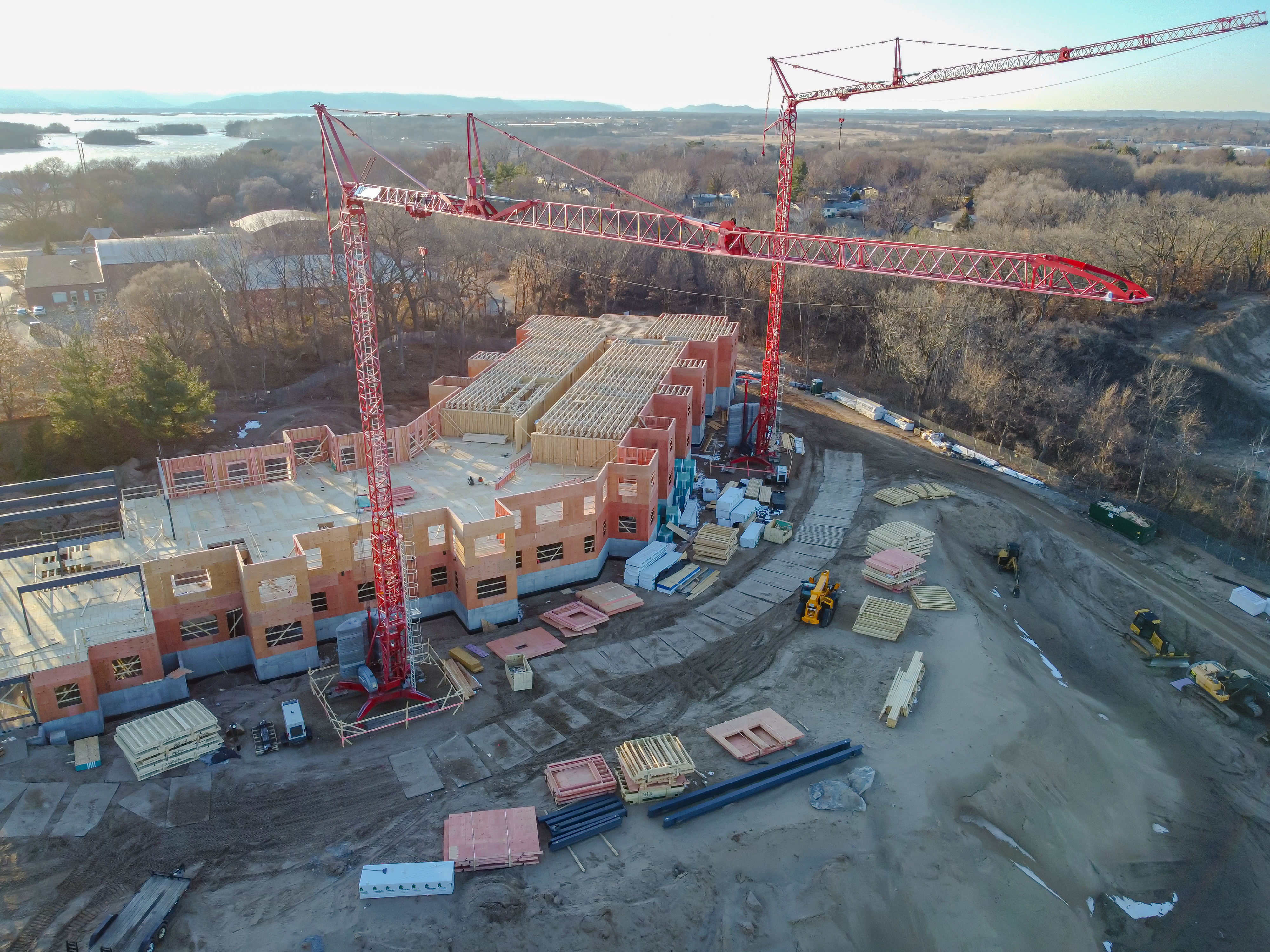
Progress monitoring asks what visibly changed between dates. Repeat overview
photographs can show where framing has advanced or a work area has opened. For a
useful report, connect each observation to a named building, level, grid, or
work package. Separate material delivered to the site from material installed
and work accepted by the responsible reviewer.
Inspection support asks a narrower question about a particular location.
FHWA's construction-inspection brief describes aerial uses in erosion control,
construction progress, quality checks, and structures. It also explicitly
retains field verification. A remote pilot's qualification to fly does not
establish competence to interpret construction work. See the
FHWA technical brief.
Measurement asks how much, how far, or at what elevation. It needs a defined
reference and checked data. Documentation preserves what was visible at a
recorded time, including the original images and their relationship to the site.
Decide which of these services is actually in the proposal; the word
“inspection” does not specify them.
A practical example is an open utility trench. Request a capture before
backfilling if the purpose is to preserve a visual record of the exposed route.
Pair it with ground records and the measurements required by the project. A
later image of restored ground cannot recover the buried installation, and even
a clear pre-backfill photograph does not demonstrate that pressure tests or
other acceptance checks passed.
Use
the six levels of drone-inspection evidence
when deciding whether the question calls for an observation, a measurement, or a
confirmed conclusion.
How photographs become comparable maps and measurements
Photogrammetry identifies matching features in overlapping images and
reconstructs their spatial relationships. An orthomosaic combines corrected
photographs into a map; a point cloud represents geometry as many spatial
points. A digital surface model describes the visible upper surface, which may
include equipment or structures rather than bare ground.
The
IDB Lab and PwC construction report
explains the progression from captured images to maps, elevation models, and
point clouds. It distinguishes a model's internal geometry from its position in
a reference system. Comparison with computer-aided design drawings or a building
information model requires the datasets to align.
Ask the receiving survey or design team to specify the coordinate system,
vertical reference, units, project grid transformation, and drawing revision. A
model that looks aligned in a viewer is insufficient for accepting a dimensional
difference.
Image resolution is not measurement accuracy
Ground sample distance, or GSD, describes the ground dimension represented by a
pixel. It does not state the error in a measured position. USGS's
imagery-calibration guidance
explains that control-point accuracy, feature matching, acquisition geometry,
and calibration affect the result. Surface texture also affects reconstruction
quality.
Ground control points have measured positions used to constrain the model. Check
points are reference points withheld from the fit and used to assess the output.
The
IDB report
describes real-time kinematic positioning, or RTK, and post-processing kinematic
positioning, or PPK, as ways to improve image-position information. For
purchasing purposes, still request independent checks of the delivered dataset.
Specify horizontal and vertical results separately, including check-point
locations and errors. For repeat surveys, require a comparison on stable
reference locations before attributing a difference to construction activity.
Where usable observations or checks are missing, mark the area unmeasured rather
than presenting interpolated geometry as a verified surface.
A volume depends on its base
A stockpile calculation needs both a mapped upper surface and a defined base.
PIX4Dmapper's volume documentation,
for example, calculates cell volumes from cell area multiplied by the height
difference between the surface and base, then sums them. The base choice
therefore affects the quantity even when the visible pile is unchanged.
An illustrative sensitivity calculation makes the issue tangible. Suppose a
1,000 m² measurement area has a uniform 0.05 m vertical offset relative to the
intended base. The resulting volume difference is 1,000 m² × 0.05 m = 50 m³.
These are hypothetical inputs, not an accuracy prediction. They show why the
report should identify the boundary, base surface, and height reference
alongside the volume.
Keep cut and fill quantities separate when both matter; a net total can conceal
substantial movement in opposite directions. Also separate geometric volume from
payable material quantity. Conversion to mass or allowance for compaction needs
additional, project-specific information.
Build the workflow around the work schedule
The following is a proposed commissioning sequence. It applies the
capture-to-delivery process described in the IDB report to a recurring
construction assignment.
- Name the decisions and recipients. Identify which reports support the
coordination meeting, quantity review, inspection request, or handover.
Assign a construction reviewer as well as a pilot. Agree who can request
another view while the feature remains accessible.
- Provide the project inputs. Supply the site boundary, work-package
identifiers, current schedule and drawings, previous capture, known control,
access restrictions, and required outputs. Flag missing or superseded inputs.
Include an owner for confirming that the proposed flight area matches the
current work area.
- Set routine and milestone capture. Choose a recurring visit around the
meeting that will use the report, then add event-based capture before
concealment or another relevant stage. Establish who gives notice when a
pour, backfill, or roof closure moves. A calendar visit alone is a poor
specification for recording a short-lived condition.
- Capture context and detail. Define repeat overview viewpoints and the
additional close views needed for each inspection question. Reassess the
route as the building and cranes change. Specify a field check of image
usability and coverage before the crew leaves.
- Process and reconcile. Check mapping quality, identify gaps, and compare
the selected dates and drawing revisions. Ask the construction reviewer to
reconcile apparent progress with site records. Preserve uncertainty in
automated classifications until the reviewer resolves it.
- Issue and close the report. Deliver findings to named recipients with
actions, due dates, and links to original records. Carry unresolved items
into the next report with their original identifiers; a new flight should not
erase an open question.
For example, specify when a Friday coordination report must arrive, then work
backward to allow processing and reviewer comments. The provider should commit
to a delivery deadline and a weather contingency, rather than simply promising
“weekly flights.” Agree how a missed capture affects that week's decisions.
Use aerial observations within the site safety program
An aerial viewpoint can help the safety team examine site layout and direct
closer attention to a location. FHWA describes examples involving excavations
and work-zone arrangements. It also recommends a job hazard analysis and
coordination between the pilot, project supervisor, and crews, particularly
around cranes and concrete boom pumps.
Before each visit, agree the launch area, current exclusion areas, communication
method, changing lifting operations, and who can stop the flight. Request a plan
for loss of control link or navigation that fits the actual obstructions. Do not
assume a route used last week remains clear after new steel or temporary works
appear.
For U.S. construction work,
29 CFR 1926.20(b)(2)
requires frequent and regular inspections of job sites, materials, and equipment
by competent persons designated by employers. A scheduled image delivery is not,
by itself, that inspection program. The responsible person must determine what
can be assessed remotely and what needs direct examination.
U.S. commercial flights commonly operate under Part 107. The
FAA's commercial-operator guidance
identifies pilot certification, registration, operational restrictions, and
possible waivers. Operations over people or moving vehicles must meet the
applicable rule conditions or require an appropriate waiver; permission from the
site manager alone does not settle flight authorization. Have the operator
resolve airspace and visual-line-of-sight requirements before committing to the
capture plan.
Require urgent observations to reach the site contact promptly, outside the
normal report cycle. Record the location and observation without declaring a
hazard resolved from a subsequent overhead image alone. Agree who will verify
the corrective action.
Specify deliverables your team can check
Use this table as a proposed scope for discussion with the provider. It combines
the source-described output types and measurement limitations above with
suggested project reporting checks; it is not a mandatory reporting standard.
Scroll horizontally to compare all columns.
Measure the service as well as the site. Useful contract measures include usable
coverage, capture-to-report time, unresolved recapture requests, and the
proportion of findings with retrievable original images. Agree definitions
before comparing providers.
For illustration, 45 usable views from a list of 50 requested views gives 45 ÷
50 × 100 = 90% capture completion. That figure says nothing about construction
completion or defect detection. If the five missing views concern work about to
be concealed, list them prominently and agree the response before concealment.
Do not accept an unexplained “percent complete.” Require the work-package
denominator and the rule for earning progress: visible installed units, measured
area, accepted quantities, or another agreed basis. State how partially
completed and unobserved work is treated. Aerial images can contribute to the
assessment; they do not define the contract's completion rules.
For the archive, agree access permissions, retention, export rights, and an exit
process before starting the subscription. Keep capture time distinct from
processing and report time. Preserve original files, with annotations and
revised interpretations clearly identified, so future reviewers can distinguish
the recorded scene from later conclusions.
Questions to settle before commissioning the service
Compare proposals against the same work areas, frequency, deliverables, and
review responsibilities. Ask:
- Which decisions will each deliverable support, and which inspection tasks
remain outside scope?
- Who interprets the images, checks measurements, and accepts the construction
findings?
- What project information must we supply, and what happens when drawings or
control change?
- How will the service capture work before concealment, including schedule
changes and weather delays?
- Can we open a sample export and trace a sample finding to its original image?
- What errors, missing coverage, or unreadable detail require recapture, and who
pays for it?
- Does the quote include mobilization, site coordination, processing,
construction review, archive access, and repeat visits?
Start with one representative reporting cycle and have the actual recipients use
it. Continue only when they can locate observations, understand omissions, check
the relevant quantities, and act before the information becomes stale. For a
small site where existing ground records answer those questions adequately, a
simpler photo process may be sufficient. Where aerial coverage fills a specific
gap, commission the complete reporting service and the remaining ground work
together.
Source notes
- FHWA, Use of Small Unmanned Aerial Systems for Construction Inspection (2019):
government technical brief on construction uses, field-verification limits,
and site coordination.
- IDB Lab and PwC, Drones in Construction (2023):
institutional industry report describing capture, processing, delivery, and
alignment with design data.
- USGS, Guidelines for Calibration of Uncrewed Aircraft Systems Imagery (2023):
government scientific guidance on image geometry, control, calibration, and
quality assessment.
- PIX4D, How PIX4Dmapper calculates the Volume:
software documentation explaining surface-to-base volume calculations.
- OSHA, 29 CFR 1926.20:
U.S. construction safety regulation, including employer-designated
competent-person inspections.
- FAA, Certificated Remote Pilots including Commercial Operators:
current U.S. Part 107 operator guidance and links to operational requirements.
Last checked: September 6, 2026.