On This Page
Define the quantity before discussing accuracy
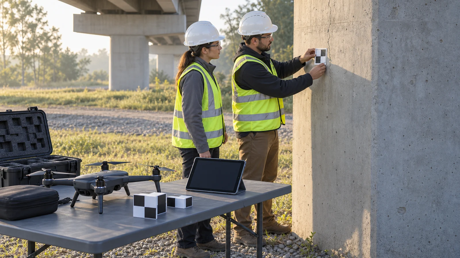
Start with the measurand, the specific quantity being measured. “Inspect the
joint” is a task. “Measure the visible joint opening at marked location J12,
perpendicular to its edges, in millimeters” defines a result that someone else
can attempt to reproduce. Width along the surface, width in a photograph and
shortest three-dimensional distance are different quantities.
NIST's guidance on uncertainty components
treats a measurement as an estimate that needs a quantitative uncertainty
statement. It also distinguishes uncertainty from error: uncertainty expresses
incomplete knowledge, while error concerns the difference from the quantity's
value. A result can happen to be close to that value even when its uncertainty
is large.
In the inspection brief, state the location, units, reference surface or
coordinate system, acquisition conditions and decision to be supported. For
change monitoring, specify the two dates and direction of change. For a thermal
finding, identify whether the requested result is an apparent hot spot, a
surface-temperature estimate or a temperature difference between defined
regions.
This definition determines what the provider must deliver. A visual record may
be sufficient to locate a suspected defect for closer examination. A numerical
repair decision requires a measurement method appropriate to that decision. Put
that distinction into the drone inspection scope of work before comparing
proposals.
Separate image detail from measurement quality
Several useful quality indicators answer narrower questions than “How uncertain
is this result?”
Ground sample distance (GSD) describes the spacing between adjacent pixel
centers on the surface. PIX4D's
GSD documentation
explains its dependence on camera geometry and distance, and notes that terrain
and viewing angle can make it vary within a project. GSD helps plan image
detail. It does not, by itself, supply the uncertainty of a measured crack width
or reconstructed clearance.
Repeatability describes agreement when measurements are repeated under
specified conditions. Repeatedly selecting the same blurred edge may produce a
consistent answer without establishing where the physical edge lies. Ask what
changed between trials: the analyst, source images, flight, control survey or
processing settings. Reopening one model is a narrower test than acquiring the
asset again.
Checkpoint differences compare reconstructed coordinates with independently
supplied reference coordinates. PIX4D distinguishes
checkpoints from fitted ground control:
checkpoints assess the model without being used to georeference it. Request
their locations and component errors, and ask whether their distribution
represents the surfaces being inspected.
A summary root mean square error, or RMSE, describes those differences
collectively. Our procurement recommendation is to request the underlying
differences and reference-survey uncertainty too. A project summary should not
be silently attached to every local dimension as its uncertainty. For the
broader positional-quality question, see how accurate drone photogrammetry is.
Likewise, an AI defect label or confidence score addresses a different output
from a dimension in millimeters. Keep AI defect detection and human review
separate from validation of the physical measurement derived from an image or
model.
Build an uncertainty budget for the reported result
An uncertainty budget lists the contributors, how each was estimated and how
each affects the output. It might include reference scale, calibration,
reconstruction, edge selection and corrections. The list must follow the actual
measurement model; adding every available software statistic can count the same
effect twice.
NIST groups evaluation methods into Type A, based on statistical analysis, and
Type B, based on other information. These labels do not simply mean random and
systematic. In an inspection budget, repeated observations might inform one
component, while a calibration certificate or justified specification informs
another.
NIST's
combined standard uncertainty guidance
calls for combining standard uncertainties with correlations where appropriate.
Recognized significant systematic effects should be corrected, with uncertainty
in the correction retained. A provider should explain that model before
presenting a final plus-or-minus value.
Suppose a provider reports a joint opening of 12.0 mm. For this teaching example
only, assume the following components are independent, already expressed as
standard uncertainty contributions to that width, and do not overlap. They are
invented scenario inputs, not demonstrated drone performance.
Scroll horizontally to compare all columns.
Combined standard uncertainty = √(0.3² + 0.4² + 0.2²) = √0.29 ≈ 0.54 mm.
Using a coverage factor of 2, expanded uncertainty = 2 × 0.54 ≈ 1.1 mm. The
rounded result is 12.0 ± 1.1 mm, with the factor and assumptions stated.
NIST's expanded uncertainty guidance
explains that multiplying combined standard uncertainty by a coverage factor
creates the expanded interval. A factor of 2 corresponds to approximately 95%
coverage only under suitable distribution and uncertainty-estimation conditions.
It is not automatically a 95% guarantee for every dataset.
If a hypothetical maintenance trigger is 13.0 mm, this interval extends from
10.9 to 13.1 mm and crosses that trigger. The measurement alone does not cleanly
settle which side the opening is on. That does not automatically condemn or
clear the asset. The responsible asset specialist must have an agreed rule for
further measurement, monitoring or intervention when the result is inconclusive.
For a real job, challenge the largest contributors first. Would clearer edges, a
different reference measurement or an independent close-range check reduce the
uncertainty that controls the decision? More photographs are useful only if they
address the limiting effect.
Treat repeat surveys and thermal readings separately
Differences between visits need their own uncertainty
A change is calculated from two results, so its uncertainty depends on both and
on how their errors relate. Shared control, alignment or calibration can create
correlation. Do not assume that the two surveys are independent just because
they were flown on different days.
Scott W. Anderson's
research on topographic-change uncertainty
shows why small correlated or systematic errors can dominate aggregate change
estimates, while uncorrelated random errors may largely cancel. This finding
concerns topographic analyses; it does not establish a universal
drone-inspection tolerance.
For a commercial comparison, request the registration method, checks on stable
areas and the uncertainty of the actual reported difference. If the task is
stockpile volume change, ask about the uncertainty of that volume change, not
just the point spacing. If it is local displacement, ask for the relevant
component and location. These are different outputs even when produced from the
same point cloud.
Avoid treating a colored difference map as a complete measurement report.
Require the analyst to identify where change is resolved, unresolved or outside
usable coverage. An unresolved difference is not evidence that no change
occurred.
Temperature uncertainty includes the scene
FLIR's temperature-measurement manual
identifies emissivity, reflected temperature, object distance and atmospheric
conditions among relevant measurement inputs. Emissivity concerns how strongly
the surface emits radiation relative to an ideal reference. Reflected radiation
can also contribute to what the camera receives.
For a numerical thermal deliverable, request the original radiometric files,
measurement-region definition, temperature range, parameter settings and
applicable calibration information. Record operating conditions relevant to the
asset, such as equipment load, so a later reviewer can judge comparability. This
is our recommended handover practice, not a claim that one manual certifies an
airborne workflow.
A camera specification alone does not quantify the uncertainty of a particular
reflective surface under unknown conditions. Where the inputs cannot be
justified, the provider should qualify the numerical result and explain what
follow-up could resolve it. A useful anomaly location can still guide inspection
even when a precise surface temperature is not established.
The following checklist is an editorial synthesis of the measurement, checkpoint
and thermal principles above. Set project-specific values with the person
responsible for interpreting the result. There is no universal tolerance
suitable for every asset and task.
Scroll horizontally to compare all columns.
Arrange the commercial workflow around these checks: agree the specification,
demonstrate the method on a representative section, acquire and inspect the
data, process and estimate uncertainty, then review the delivered results
against the intended decision. Put recapture and additional-measurement
responsibilities in the contract before a borderline result creates a dispute.
Ask for one completed example record during procurement. It should connect an
asset location to the original data, measurement result, uncertainty statement
and resulting action. A sample report with only polished images and unexplained
decimal places cannot show that connection.
Ask the provider to demonstrate the decision
Before commissioning the full inspection, ask:
- Which quantity does the quoted accuracy describe: aircraft position, model
coordinates, a local dimension or temperature?
- Which uncertainty components were evaluated on comparable surfaces and
conditions?
- Which checks were independent of the reconstruction or calibration being
assessed?
- How were correlations, corrections and overlapping components handled?
- What does the coverage factor mean, and what evidence supports its
interpretation?
- How will the report handle a result that crosses the agreed trigger or cannot
be measured?
Choose the method after reviewing that example, not after comparing decimal
places in proposals. If its uncertainty is too large for the decision, change
the measurement approach or commission a closer independent check. If visual
screening is all the evidence supports, buy and label it as visual screening.
The deliverable should make its useful limits clear enough that the asset owner
knows what to do next.
Source notes
Last checked: September 10, 2026.