On This Page
Specify the deliverable before the flight
Start with the person who will use the result: the geotechnical team, survey and
inventory team, or road-maintenance supervisor. Ask what decision is waiting and
what evidence would change it. That prevents a proposal for a general site map
from becoming an assumed commitment to detailed inspection of every face, pile,
and road.
Three scopes to put in the purchase specification
Scroll horizontally to compare all columns.
This is an editorial procurement synthesis of the NIOSH highwall study, Pix4D
volume guidance, and Bald Mountain haul-road study discussed below. It specifies
useful outputs rather than universal accuracy requirements.
Keep the scope measurable. Replace “inspect the whole highwall” with named
faces, benches, and required views. Replace “accurate stockpiles” with
identified piles, units, a documented base, and an agreed checking method.
Replace “road condition dashboard” with exports the maintenance team can locate
and act on.
Match the capture to the surface
Photogrammetry estimates three-dimensional geometry by matching features across
overlapping photographs. The resulting point cloud is a collection of located
surface points; an orthophoto is an image corrected for mapping use. A top-down
map and a detailed model of a steep face require different viewing geometry.
Pix4D's
image-acquisition guidance
distinguishes corridor mapping from reconstruction of vertical objects and
explains the need for overlap between image sets. Applied to a mine, this means
planning views of the highwall itself instead of assuming an overhead stockpile
flight also captures the wall adequately. The software guidance is a starting
point for capture design, not a mine-specific flight prescription.
Ask for a coverage review before the team leaves. Deep shadow, occlusion behind
a bench, weak surface texture, or inadequate overlap can leave a visually smooth
reconstruction with poorly supported areas. Water is especially problematic for
image matching: reflections and moving surface patterns do not provide
dependable fixed features. Mark those areas as unmeasured or needing another
observation.
Separate image detail from measurement quality. The
USGS calibration report
connects flight geometry, camera calibration, ground control, and quality
checks. A small ground sampling distance, the ground distance represented by a
pixel, is not a stand-alone accuracy certificate. Require the provider to
identify the horizontal and vertical reference, units, control method, and
checks relevant to the proposed outputs.
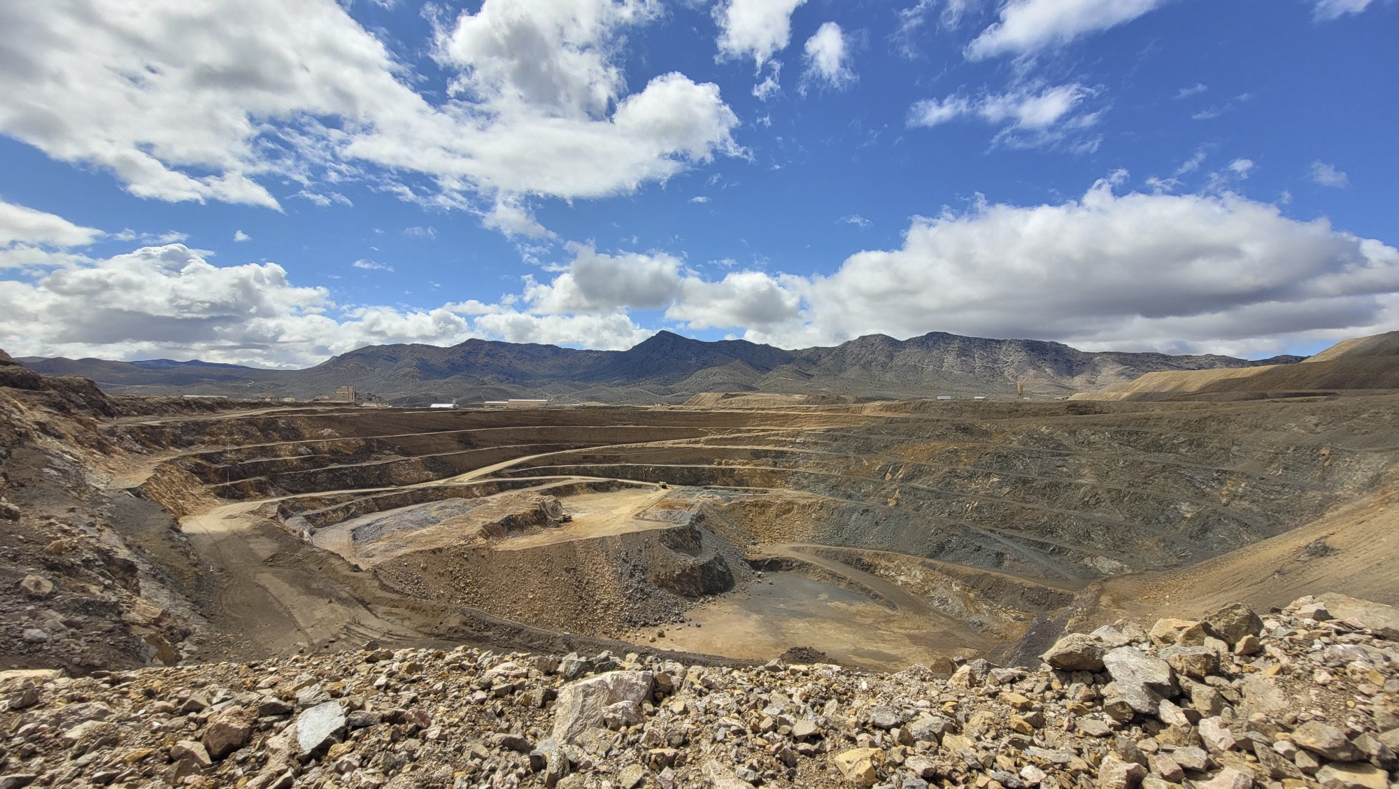
Highwalls: document geometry and visible change
For highwalls, the useful product is a record that the geotechnical team can
interrogate: where the face was visible, how benches and accumulated material
were represented, and where current observations differ from the reference
survey. Request original photographs alongside the model so apparent features
can be checked against the images.
NIOSH researchers used pre- and post-test drone photogrammetry in a
rockfall testing program at open-pit mines.
The models supported analysis of bench geometry, rock travel, and catchment. One
reported lesson was that obtaining a model before testing helped identify
differences in bench configuration that otherwise complicated interpretation.
This demonstrates a role for measured geometry in a defined investigation; it
does not establish that routine imagery predicts rockfall.
For repeat surveys, ask which stable references align the dates and what amount
of apparent change the method can distinguish from measurement error. Set a rule
for reviewing suspicious differences before labeling them movement. Changing
shadows, missing views, excavation, and processing differences need
consideration alongside physical change.
A drone survey is also a dated observation. It cannot show what happened between
visits or reveal an unobserved internal failure surface. Agree who receives
urgent observations, who interprets them, and what additional monitoring or
examination is required. The publication's guide to
what drone-inspection evidence can prove
explains the progression from observation to supported diagnosis.
Stockpiles: define the base before calculating volume
Volume is the space between the measured pile surface and the chosen base within
a defined boundary. The drone sees the exposed pile; it does not reveal the
floor buried beneath it. Pix4D's
stockpile guidance
explains why the reference base matters and describes using a supplied base
surface for more complex conditions.
Request the base file or assumption with every volume report. A surveyed empty
pad, a documented earlier surface, and a plane inferred from perimeter points
are different inputs. Piles against walls, joined piles, and sloping pads
deserve an explicit boundary and base review before comparing results.
Consider this illustrative calculation, not a measured mine result. If a base is
placed uniformly 0.10 m too high over a fixed 2,000 m² footprint, the calculated
volume is understated by approximately 200 m³:
Volume difference = footprint area × base-height error = 2,000 m² × 0.10 m = 200
m³.
The example assumes the footprint and upper surface remain unchanged and
material covers the entire affected area. It shows why a base decision can
matter even when the visible surface looks detailed; it is not a total
uncertainty estimate.
If the inventory needs tonnes, record the conversion separately: mass in tonnes
equals volume in cubic metres multiplied by bulk density in tonnes per cubic
metre. Propeller's
stockpile documentation
likewise treats density as a supplied material property for calculating mass.
Require the mine's appropriate density basis, including the relevant material
and moisture condition. The survey does not measure density.
For a repeat inventory, record the capture interval and material movements
during it. Otherwise a difference between surveys may combine actual loading,
changed pile boundaries, changed base assumptions, and survey error. The
inventory owner should be able to reopen both calculations and explain the
difference.
Haul roads: turn observations into maintenance locations
A road survey is useful when a supervisor can locate the issue and assign work.
Name the road, direction, chainage or distance along its reference alignment,
and observation time. Attach an image and the relevant profile or cross-section
to each item rather than delivering only an undifferentiated surface model.
The
Bald Mountain mine case study
used orthophotos and elevation models to examine road geometry and identify
features including water, spillage, and potholes. It also documented a practical
failure: a grader present during capture produced a false peak in a road profile
when it was not removed successfully from the data.
Require the provider to explain how vehicles and other temporary objects were
handled, and where filtering leaves insufficient observations. A smoothed or
filled gap should not silently become a road measurement. Compare geometric
outputs with the mine's actual design criteria; an isolated slope value does not
establish whether that section is suitable for its intended traffic.
Use the findings to request inspection or maintenance, then record the
disposition. Imagery may show standing water without establishing whether the
cause is blocked drainage, surface deformation, or another condition. Claims of
reduced tyre wear, fuel use, or cycle time need separate operational
measurements; the existence of a drone map does not demonstrate those savings.
Run a repeatable commercial workflow
Treat capture, interpretation, and delivery as one service. The following
sequence is an editorial commissioning recommendation based on the measurement
dependencies above.
- Agree the scope. Identify the decision owner, mapped boundaries, required
detail, output units, reference system, checking method, and delivery
deadline.
- Prepare site inputs. Supply available design surfaces, earlier surveys,
pile identities, operating windows, access restrictions, and the mine's
flight and work coordination requirements. Establish who can pause or cancel
collection.
- Review capture completeness. Check coverage and image usability while
recollection is still possible. Record omitted areas and the reason; agree
how missing evidence will be obtained.
- Process and check. Retain source imagery, processing settings, control
records, and independently checked results. Keep checkpoints used to test the
output separate from points used to fit it. Review each task-specific output,
including pile bases, highwall gaps, and road obstructions.
- Deliver into the mine's tools. Trial representative files in the
recipient's survey, GIS, CAD, or maintenance system. Request suitable image
rasters, point clouds, surfaces, tables, and located observations as needed,
with coordinate and unit information attached.
- Close the action. Have the recipient accept the deliverables, request
corrections, or reject unsupported measurements. Keep observations linked to
subsequent investigation or work orders.
Where a provider offers compliance with a positional-accuracy standard, ask for
the exact edition and report. The
ASPRS 2024 revision announcement
describes expanded guidance for UAS and oblique mapping and consideration of
checkpoint survey accuracy in final product accuracy. A statement such as
“survey grade” is less useful than a named method and the actual results for the
delivered dataset.
Commercial comparisons should include mobilisation, site coordination, survey
control, processing, specialist interpretation, storage, export access, and
recollection terms. Request an agreed breakdown rather than comparing flight
charges alone. Measure service performance through usable coverage, delivery
time, corrections needed, and whether the recipient can act on the outputs;
establish any financial benefit separately.
Questions to settle with a provider
Before commissioning routine work, ask for a representative deliverable and
answers to these questions:
- Which surfaces will be observed, and how will inaccessible or unreliable areas
be reported?
- What supplied control, base surveys, designs, and previous data are required
from the mine?
- How will the team demonstrate measurements are suitable for each intended use?
- Can the mine export and reopen the original observations, surfaces,
boundaries, and reports after the service ends?
- Who interprets highwall observations and investigates road findings, and who
owns volume-to-mass assumptions?
- What triggers recollection, who pays for it, and how are urgent findings
communicated before the final report?
Use the first commissioned survey to test the complete handover. The
geotechnical team should be able to examine a named face, the inventory team
should be able to reproduce a pile calculation, and the maintenance supervisor
should be able to locate a road observation. Expand recurring coverage once
those outputs support the intended work.
Source notes
- Pix4D: Selecting the Image Acquisition Plan Type.
Provider technical guidance on overlap, viewing geometry, corridors, and
difficult surfaces.
- USGS: Guidelines for Calibration of Uncrewed Aircraft Systems Imagery
(2023). Government guidance on geometric quality, calibration, control, and
checks.
- NIOSH researchers: Designing a Rockfall Testing Program for Open-Pit Mines to Investigate Runout and Bench Catchment
(2024). Original research describing drone models within controlled rockfall
investigations.
- Pix4D: Stockpile Volume Calculation with Photogrammetry
(2017). Provider explanation of base-surface choices; historical accuracy and
adoption claims are not used here.
- Propeller: Measuring Stockpiles, the Basics.
Provider documentation on boundaries, volume comparisons, exports, and
supplied material properties for mass calculations.
- Medinac and colleagues: Haul Road Monitoring in Open Pit Mines Using Unmanned Aerial Vehicles
(2020). Original Bald Mountain case study, including road outputs and a
vehicle-related modelling artifact.
- ASPRS: Adoption of Edition 2, Version 2 Positional Accuracy Standards
(2024). Standards-body account of revised accuracy reporting and mapping
guidance.
Last checked: September 6, 2026.