Compare complete architectures
Latency, throughput, range, and availability belong to a configured end-to-end
path in a stated environment. A technology label alone supplies none of those
values. The matrix gives selection questions, not universal rankings.
Scroll horizontally to compare all columns.
SWaP means size, weight, and power. For a flight system, include mounts,
antennas, cables, converters, routers, cooling provisions, and installation
effects rather than comparing bare modems.
Direct radio gives control over a bounded path
A private point-to-point or point-to-multipoint radio lets the operator choose
ground-site placement, antennas, waveform, traffic policy, and often the local
backhaul. It can fit a work site or surveyed corridor where the organization can
establish the coverage volume and maintain the ground equipment.
Control over the equipment does not remove propagation limits. NASA's
account of air-ground UAS radio testing
identifies terrain, vegetation, buildings, water, weather, and antenna geometry
as variables that can change the path. A related
NASA L- and C-band propagation study
measured different environments rather than treating radio range as a fixed
circle around a mast.
The operator also owns more of the infrastructure. A mast needs a site, power,
protection, maintenance, and possibly backhaul. A longer corridor may require
overlapping ground stations and a verified handoff. Increasing transmitter power
alone does not resolve terrain masking, antenna nulls, interference, equipment
limits, or spectrum authorization.
Direct radio is most legible when the route can be surveyed and the supporting
sites can be controlled. Its acceptance evidence should show the installed
aircraft antenna, every planned attitude, route-edge performance, ground-site
dependencies, and recovery after handoff or obstruction.
LTE adds managed mobility and carrier dependencies
LTE can put a compact modem and antennas on the aircraft while relying on a
carrier's radio access network, mobility management, core, and backhaul. That
can suit a corridor where the carrier supports the device and use, and where the
installed system has been measured along the intended route and altitude.
The existence of an LTE standard does not establish airborne service on every
public network. The official
3GPP aerial-vehicle study
documents technical work for enhanced LTE support. Carrier deployment, frequency
holdings, altitude behavior, interference controls, roaming, priority, and
enterprise network features remain network- and region-specific.
A ground coverage map is not installed-aircraft evidence. Greater height can
improve line of sight to several towers while also exposing the modem to a cell
and handover environment unlike a handset on the ground. Validate the exact
carrier, subscription, SIM or eSIM, APN, antennas, aircraft attitudes, altitude,
route, traffic load, and endpoint.
Failure analysis should reach beyond signal strength. Tower power, backhaul, the
carrier core, congestion, handover, account state, address translation, and the
ground application's Internet path can each interrupt service. Two carrier
subscriptions can still share a tower, fiber route, cloud gateway, onboard
router, antenna placement, or power rail.
Satellite trades local towers for sky view and provider control
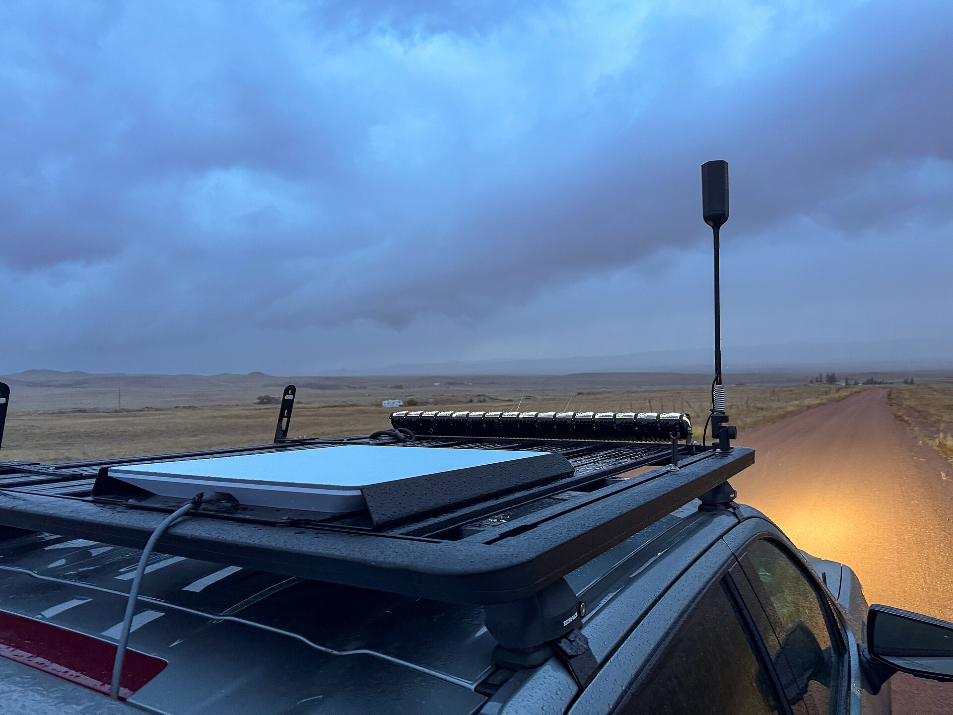
A low-Earth-orbit satellite service can carry data where terrestrial
infrastructure is sparse. It still depends on infrastructure: the installed
terminal, unobstructed sky view, electrical and thermal support, the provider's
space and ground network, an authorized service, the Internet path, and the
operator endpoint.
A NASA C2 architecture concept
compares terrestrial radio, cellular, and satellite as end-to-end systems with
different infrastructure, bandwidth, latency, and maturity considerations. It is
a research concept, not a current service specification. Its useful lesson is
architectural: a satellite bearer does not supply aircraft integration, traffic
priority, session recovery, command authentication, link monitoring, or operator
presentation.
Satellite becomes plausible when the aircraft has enough installation margin for
the terminal and when the route provides a verified view of the sky. It can be a
poor fit for a small battery aircraft, a low route beside obstructions, or an
operation that assumes one consumer Internet session is a continuous C2 service.
The Starlink drone integration analysis applies
these questions to a specific terminal class without generalizing one service to
every satellite system.
Mesh adds routes only while nodes remain connected
A mesh forwards traffic through intermediate nodes. It can extend a local
network across an incident area, fleet, temporary site, or terrain where an
aerial relay restores line of sight. It does not create coverage without enough
nodes in usable positions.
NIST's
rapid-deployment mesh research
examines time-varying link quality, multihop relay placement, and network
testing in difficult environments. NASA's
ACERO field test
provides a UAS example: portable units shared information through a mesh, and a
larger aircraft acted as a communications relay without depending on the
Internet.
That example does not make mesh an unlimited-range service. Every hop consumes
power and airtime. A shared channel can become congested; an overloaded relay,
moving node, or lost gateway can degrade the graph. Alternate routes may share
the same spectrum, routing implementation, credentials, power source, or
backhaul.
Mesh fits when node placement and density can be managed as part of the mission.
Acceptance should cover route formation time, per-hop load, gateway capacity,
node motion, loss of the most important relay, network partition, and stable
recovery.
A hybrid is useful only when its diversity is real
Several status icons do not prove several independent paths. Map what the links
share:
- onboard power, wiring, antennas, router, and compute;
- ground power, backhaul, control station, and application;
- towers, provider gateways, Internet exchanges, or cloud relays;
- identity, credentials, account administration, and configuration; and
- health data and software used to select a path.
An
FAA-hosted link-diversity report
documents one managed combination of C-band, LTE, and Starlink. The final data
collection used a Cessna 182 carrying UAS avionics during 15 Montana flights.
Those results demonstrate that automated selection was implemented in that test
configuration. They do not establish generic availability or latency for any of
the three transports.
Selection logic adds its own interface requirements. Define what makes a path
qualified, how stale health data are rejected, how ordering and authentication
survive a switch, whether sessions persist, what the operator sees, and how the
system avoids oscillating between weak paths. The
C2 interface-control guide owns
those integration details. The
lost-link procedure guide addresses the
aircraft and crew response when the required service is no longer available.
Spectrum authority and flight authority are separate
In the United States, current
47 CFR Part 88
governs UAS use of the 5030 to 5091 MHz band and defines control and non-payload
communications separately from payload information. Its non-networked access
framework limits assignments to CNPC. Several authorization, frequency
management, and equipment provisions still show indefinitely delayed effective
dates, so the regulation must be read section by section before planning access.
Unlicensed equipment remains subject to its band-specific rules. For example,
47 CFR 15.407
prohibits transmitters in 5.925 to 7.125 GHz from controlling or communicating
with UAS. A familiar Wi-Fi label does not establish that the installed channel,
power, equipment, and airborne use are permitted.
Communications authority also does not grant aviation authority. FAA
advanced-operation application instructions
ask applicants to describe the C2 link, lost-link threshold, and contingency
behavior. Naming LTE, satellite, mesh, or direct radio is only an input to that
operational case.
Build the selection from route evidence
For each candidate, record the same facts:
- information flows and the consequence of delay, corruption, or loss;
- directional sustained, peak, and degraded-state traffic;
- coverage volume, route geometry, aircraft attitudes, and obstructions;
- latency distribution, data age, outage duration, and reacquisition;
- installed SWaP, thermal, aerodynamic, and electromagnetic effects;
- ground infrastructure, provider, account, and endpoint dependencies;
- spectrum, equipment, service, and aviation authority;
- observable health, path-selection behavior, and operator indication; and
- failures the alternate path covers and dependencies it still shares.
The drone bandwidth sizing method
turns traffic into directional capacity requirements. Then test the complete
path under normal load, peak load, route edges, attitude changes, handoffs,
provider or gateway transitions, and loss of each claimed backup.
The result may be one well-characterized bearer or a managed hybrid. Direct
radio offers control where the operator can support the path. LTE offers managed
terrestrial mobility where airborne service is verified. Satellite can extend
reach when its installation and service fit. Mesh can add local spatial paths
when enough managed nodes remain connected. The mission evidence, not the
technology label, decides which architecture fits.